Introduction
Bengaluru was known to have over 1000 lakes. The earliest record of a lake in Bengaluru dates back to the 16th century when the founder of Bangalore Kempe Gowda, started constructing artificial tanks for irrigation, fishing and drinking water. Since then, the lakes have been expanded and adapted under the succeeding Mysore Kings and under British colonial rule. Lakes not only helped improve Bengaluru’s micro climate, they also helped in replenishing ground water and provided sources of livelihood to many. Most of Bengaluru’s lakes are actually irrigation tanks. These lakes, apart from being used for irrigation also had environmental uses. Some of which are flood control, water storage, groundwater recharge, domestic uses etc. For example, Dhobi Ghat became a center for people to wash and dry clothes. In the recent years these lakes have been converted to residential areas, bus stands, stadiums etc. Few notable conversions are: Dharmambudhi kere converted into the Kempegowda bus stand, Vijinipura lake into Rajarajeshwari layout, Jakarayana kere into Krishna floor mill, Hennur lake into the HBR Layout, Shoolay lake into a football stadium etc. The condition of lakes in Bengaluru are often polluted. They are subjected to dumping of building debris, untreated domestic sewage, industrial effluents etc. Each land use around the lake contribute to a different kind of pollution. For example, lakes in industrial areas see discharge of heavy metals and detergents, agricultural areas see harmful fertilizers and commercial or residential units see untreated sewage and building debris. A field survey of 105 wetlands (Ramachandra et al., 2016) showed that 98% of lakes have been encroached by illegal buildings, these could be high rise apartments, commercial building, slums, etc. Another field survey (IISc, “Wetlands”) of lakes in 2014-15 showed that nearly 90% of lakes are fed by untreated sewage, 38% are surrounded by slums and 82% showed loss of catchment area. It also revealed that these catchments were used as dumping yards for either municipal solid waste or building debris. When spaces and areas around lakes in urban areas are observed, it can be seen that they are prone to flooding. One of the primary reason for this is the encroachment of lake beds and Rajakaluves.
Rajakaluves and the interconnected nature of lakes in Bengaluru
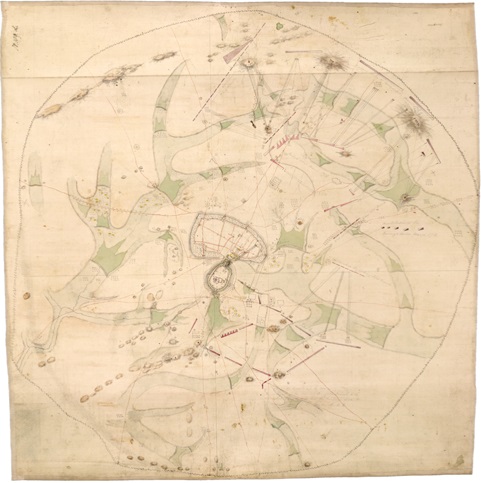
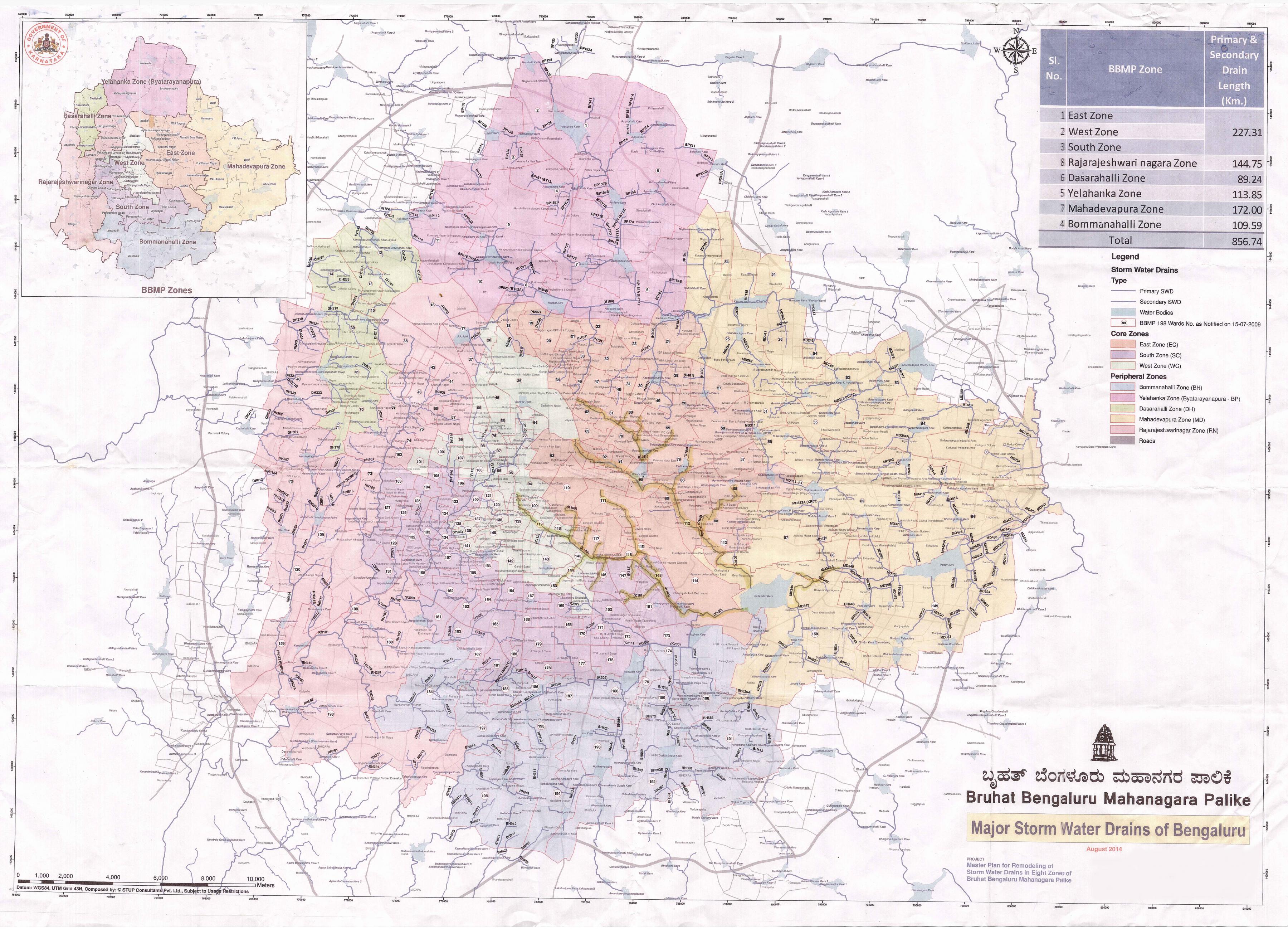
Rajakaluves are storm water drains that connect lakes in Bengaluru. These kaluves form an interconnected cascading system of lakes in Bengaluru.These drains or kaluves are designed to regulate water flow from higher elevations to lower elevations. The city is located at an altitude of 920 metres above the sea level and the natural flow of water is away from the city into the surrounding valleys. Each valley gives birth to smaller streams which cascade down to form major stream systems. The city also has other natural water resources. There are 3 rivers which flow through Bengaluru i.e. Vrishabhavati, Arkavathi and Dakshina Pinakini. Other water resources are open well and private borewells. There are 4 main valley systems in Bengaluru. They are Arkavathi valley, Hebbal - Nagavara, Vrishabhavathi and Koramangala Challagatta.
 {width=“35%”}
Rajakaluves as public infrastructure
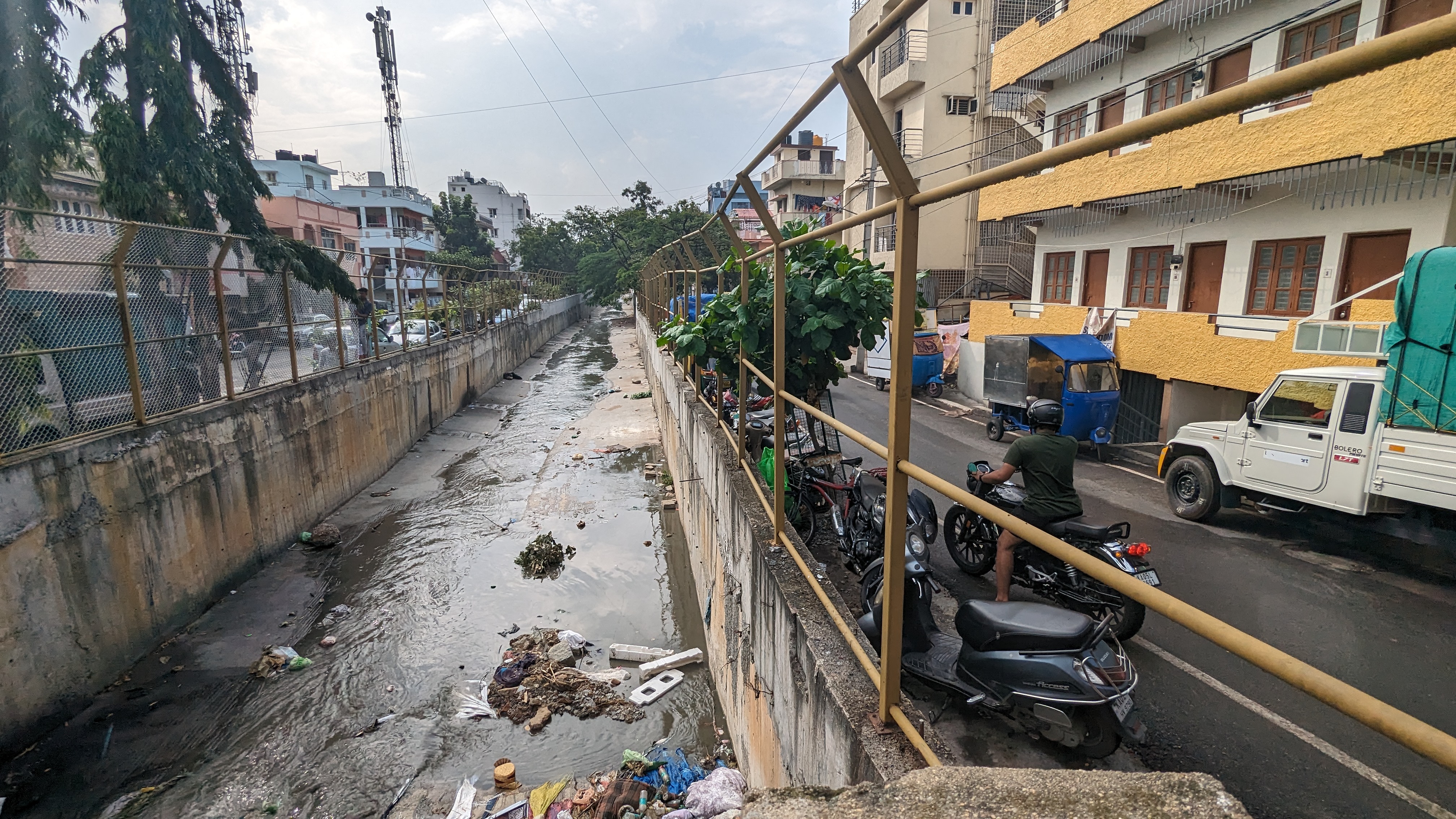
Rajakaluves pass through different parts of Bengaluru. They almost cut through them to make slices of the city. Initially these water bodies were clear and seen as streams eventually the BBMP started building walls around it to create a path for the flow of water. This later tranformed more as the areas became more urbanised. They became a dumping space for a lot of waste. The authorities put up grills and fences around these spaces to avoid disposal of waste. Yet these Kaluves continue to be prone to lot of waste even today. Moreover untreated sewage water was let into these raja kaluves and that would mix with rain water. This meant that in most seasons the kaluves ran dry with just sewage water and a lot of waste. The poor condition of these meant that there is a lot of smell in the vicinity. Shop owners often complained that customers hesitated to enter shops because of the smell. Prahalad, a development officer in the BBMP mentioned in an interview that the area around this land was often also a spot for rowdy elements and anti social elements (K100 citizen’s Waterway documentary, 2023). The area around these Rajakaluves are often unused for residential purposes, mostly temporary residences of low income groups.
The K100 project
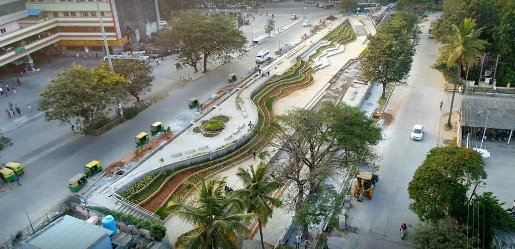
The K100 Citizen’s waterway is an initiative taken up in Bengaluru to rejuvenate a stretch of Rajakaluve. This kaluve is a historically significant rajakaluves which starts from Shanthala Silks near Kempegowda bus stand, and drains into Bellandur Lake. The catchment area spans 32 sq km, which includes the historic city, cantonment and newly-formed layouts post-independence. This waterway can be seen in maps of the area dating back to 1885 (Rajagopal, 2022). As the city grew outward with increasing population and industry, the rajakaluve started to get more and more channelised. The once clean path for rain water to flow eventually turned into a garbage dump and untreated sewage water was being discharged into it. The kaluve according to the locals, existed from the time of the British Raj. The area around the kaluve also seemed unsafe and became a center for anti social elements. The K100 project aimed at rejuvenating this kaluve and designing it with people as a part of public infrastructure. The key design interventions for this project were:
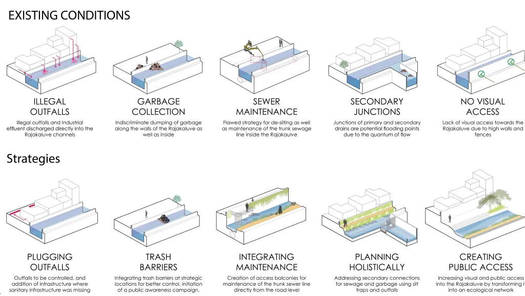
- Treating sewage: Elimination of sewage inflow and untreated industrial effluents in the rajakaluve. This also involved removing garbage dumping. A lot of sweage pipes were connected to this Kaluve and those had to be redirected. One of the main interventions involve setting up a sewage treatment plant at the upstream of the kaluve and releasing treated sewage water into these kaluves. This ensured 24/7 running water on all 365 days
- De-silting: This process involved the removal of contaminated silt from the drain beds. Using natural materials and natural bio-remediation techniques to improve water quality as well as increase natural infiltration. This process proved to be a major challenge. The SWD Department has ramped up efforts to desilt the secondary drain network across the entire 32 sq km catchment area. This is a difficult task since this network has 10 secondary SWDs, which includes 11.5 km of open drains and 9.6 km of closed drains.
- Creating pedestrian-friendly infrastructure: One of the main intents of the project was to re think of rajakaluves as a part of public infrastructure. Cleaning up the space was the first step to this, the next step was to design the infrastructure around it. The complete design of the K100 is yet to be implemented as of October 2023, but the plan involves creating walking and cycling paths around the stream. These paths cover the distance of the stream itself and could be also seen as an alternate means of commute from Shanthinagar to Koramangla. Additionally these spaces also intend to have benches, plants and other spaces which could be accessed at any time of the day.
Thyagarajanagar - Hoskerehalli kaluve
To further understand Kaluves, a stretch of kaluve present in Thyagaraja nagar was studied. Studies were done through primary field visits, talking to locals and Google street view analysis. The kaluve connects to the Hoskerehalli lake. It traverses from Thyagaraja nagar, Girinagar, Hoskerehalli etc. This paper presents the findings of a study of the space informed by secondary and primary methods. The prominent features of the space include mixed land use, close buildings, garbage dumping. The reason it becomes important to consider land use around the space is because reimagining a space like this then comes with a constraint of not harming the buildings, both residential and commercial.
Google street view analysis
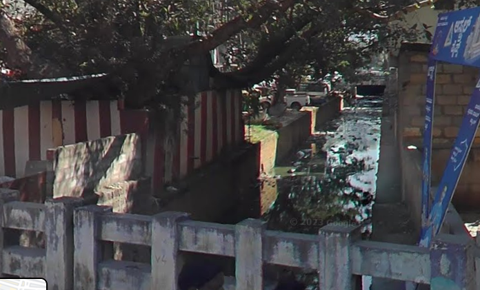
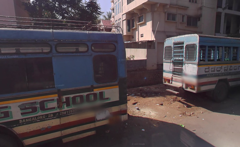
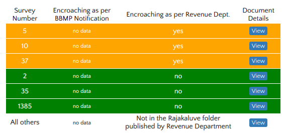
The primary stretch focused in this street view analysis is the one in 14th cross road of Thyagaraja nagar. The land use around the area appeared to be very mixed. There were temples, commercial shops which were at the intersection of the road. There was a temple situated right on top of the Kaluve. There was a driving school nearby and the empty space around the drain was used as parking for heavy vehicles. Another part of the kaluve was very close to apartment buildings. There seemed to be buildings on the boundary walls of the kaluve. As per the rules by the BBMP there needs to be a distance of 3 metres from the center of the drain which seemed absent in a lot of buildings around this kaluve (Initiative, Rajakaluve encroachment finder 2016). Thus a lot of the land seemed to be encraoched by building spaces. According to the data released by the revenue department, there is data available for three survey numbers that have documented encroachment. The kaluve itself however is filled with a lot of garbage. The roads built around the kaluve are narrow and sometimes cause traffic congestion as well. The main problems in this area seem the garbage disposal and the unhygenic environment.
 {width=“80%”}
 {width=“80%”}
 {width=“70%”}
Following the kaluve by road
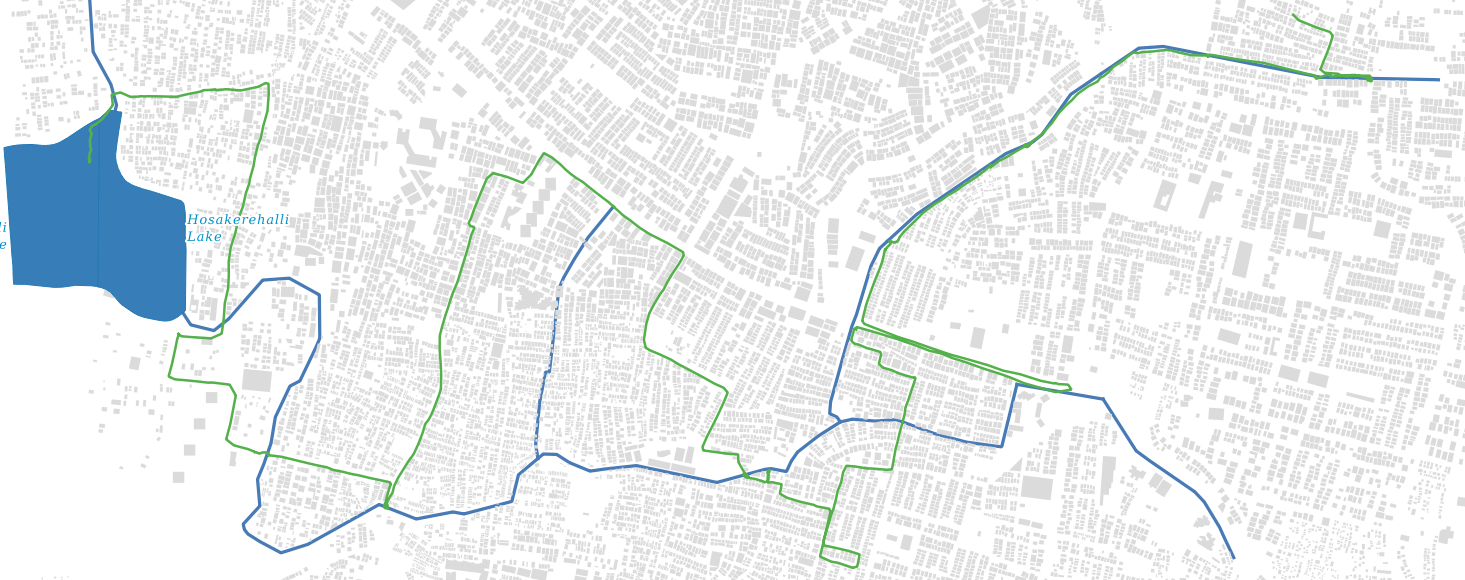
To further understand the Kaluve a primary field visit was conducted. The kaluve was studied at every stage from its source in Thyagaraja nagar to its end point in the Hoskerehalli lake. The kaluve was already mapped on Open street maps and it was used to follow the path of the drain. The distance was covered on a bike and field interviews, photo documentation was done throughout the distance. The activity was primarily useful in understanding the nature of a kaluve as an infrastructure and the way public engages with the space. Given below are some trends and observation.
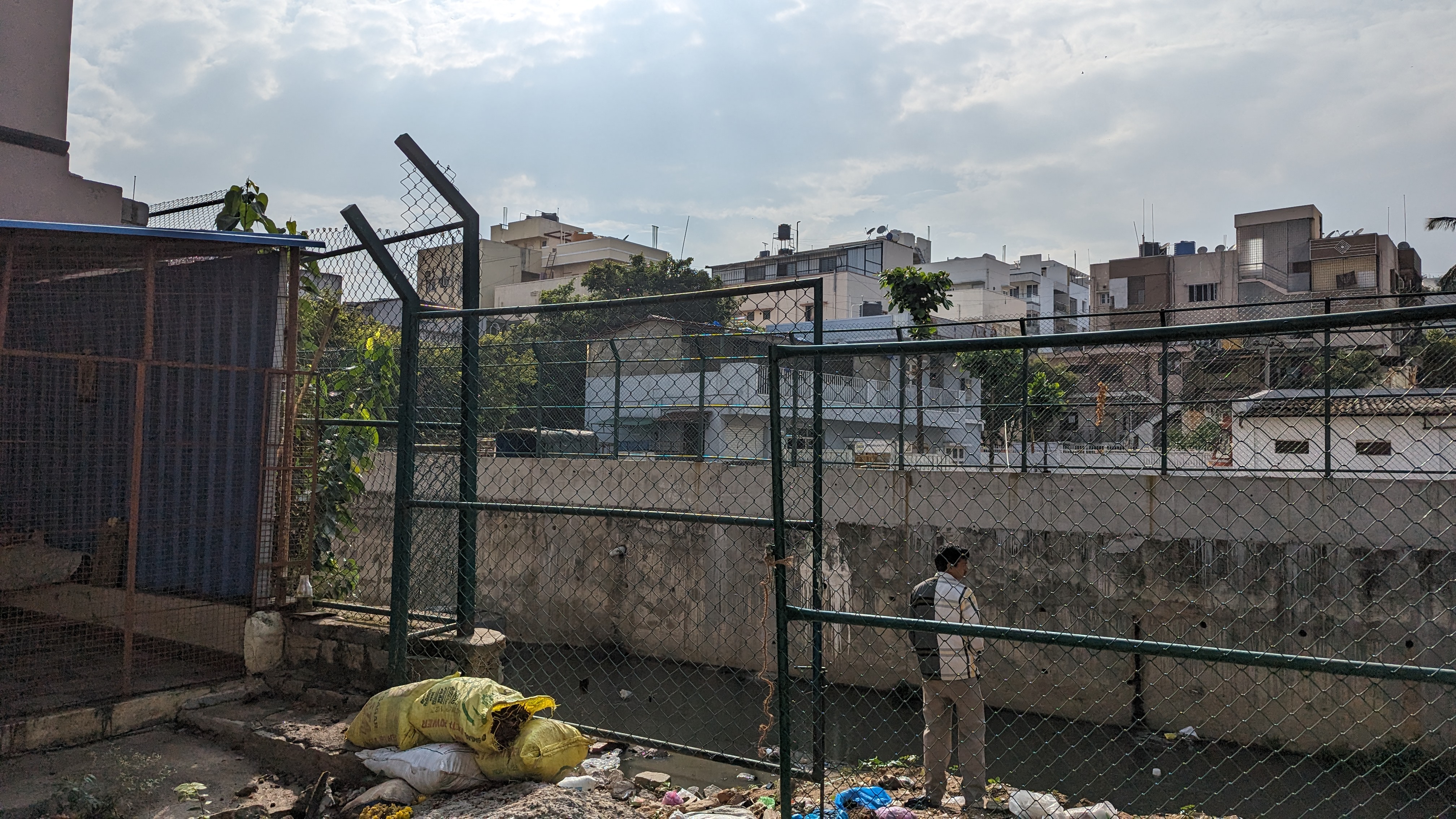
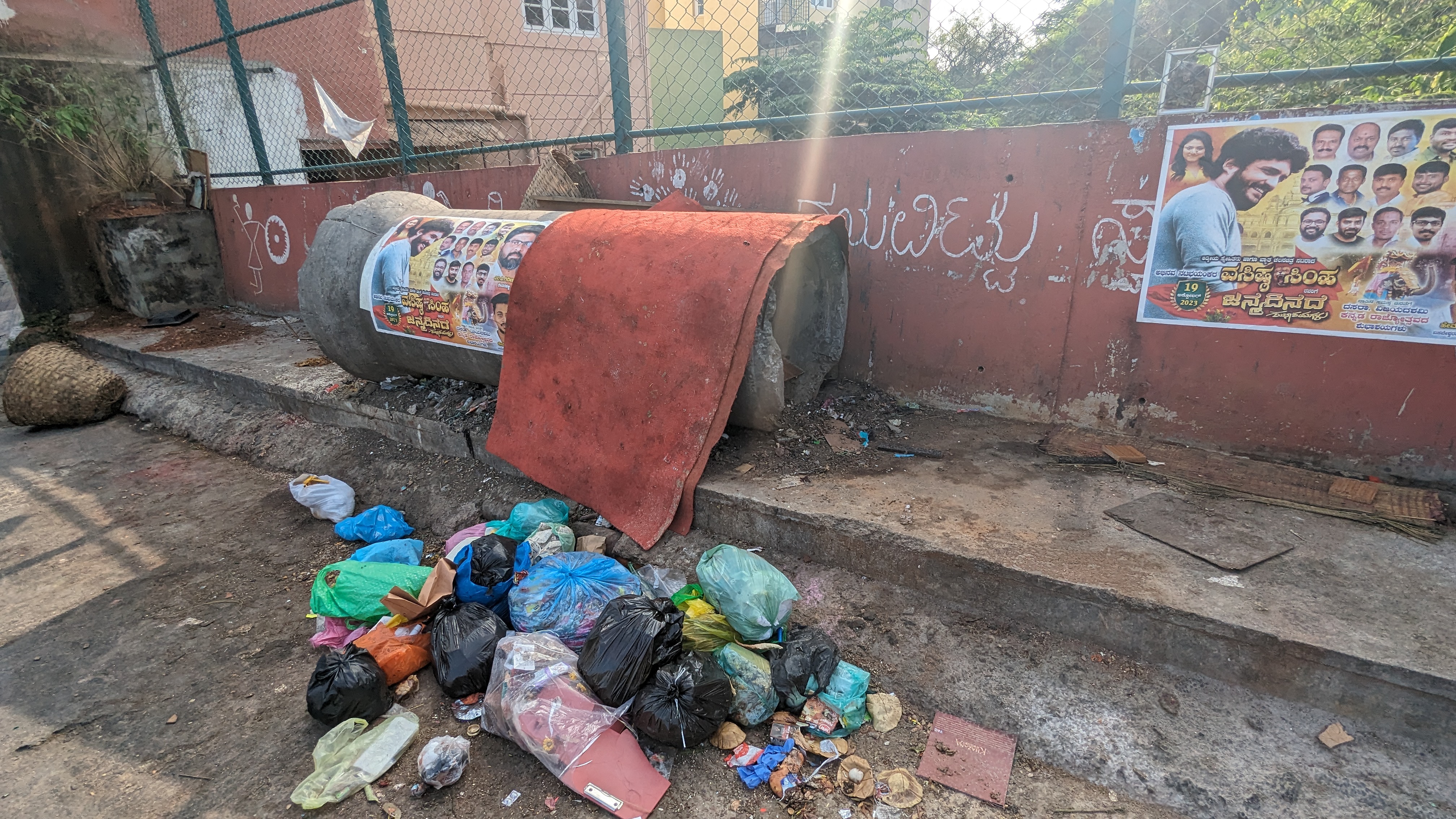
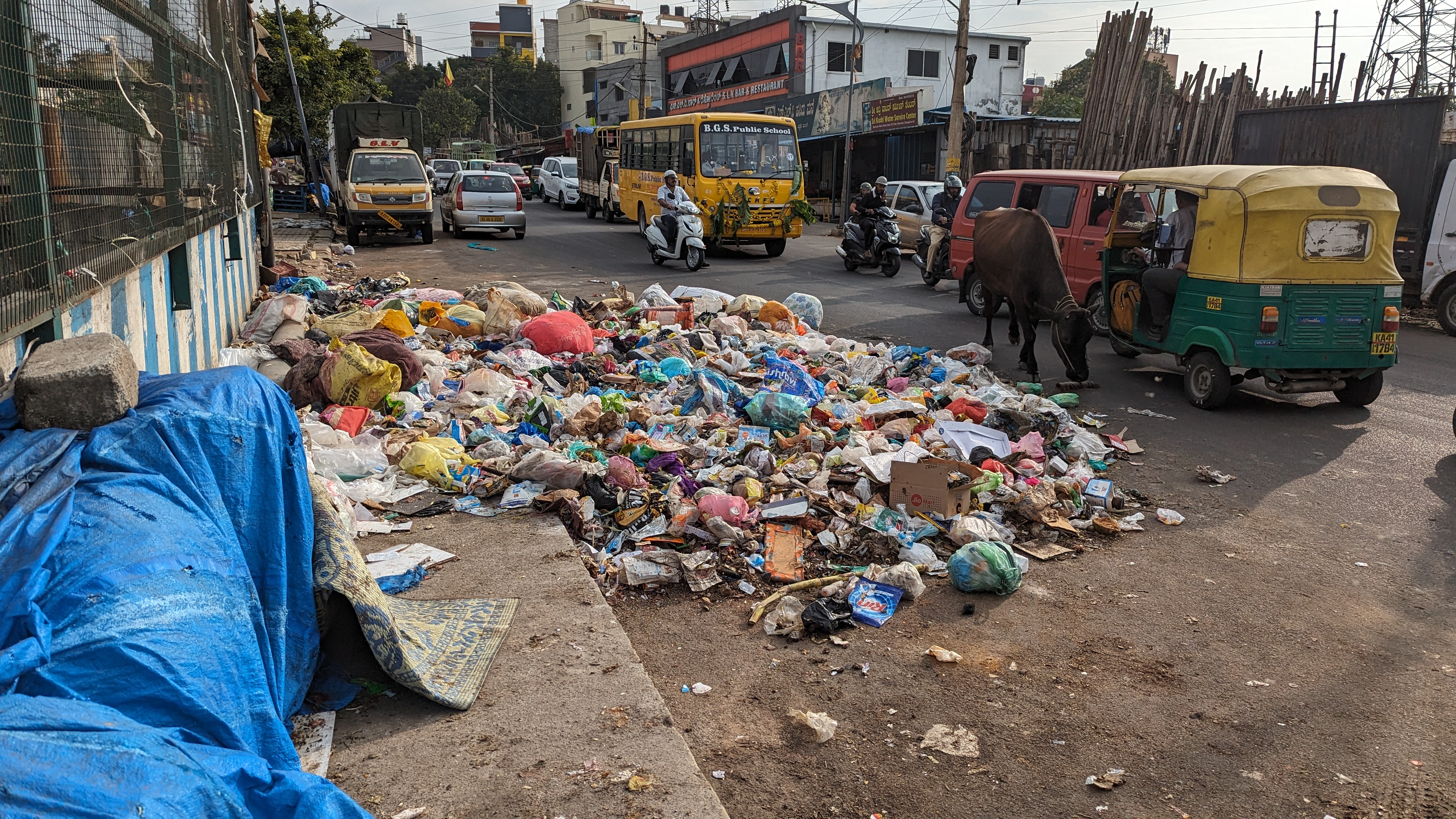
- The kaluves are very often used as dumping yards. This was an insight that was gathered through secndary research and it was strongly confirmed by primary visits. Both the water flowing and the area around it are commonly filled with garbage. The waste is mostly plastic, waste from houses etc. The areas around the kaluve were additionally damp and filled with plastic/food waste. Therefore one can commonly spot domestic animals like dogs, cows trying to find food in these dumps. The area if isolated is also used for urination by men and animals alike.
::: {layout-nrow=“2”}
 :::
:::
- There were temporary settlements around the kaluve at some places. These were often houses with built with stone, with sheet roofs. They were either small houses or commercial spaces like a tea/pan shop or a condiment store. A shop owner also stated that the kaluve has not caused any harm to their establishment apart from the smell. There have been no cases of water overflowing or flooding into these spaces.
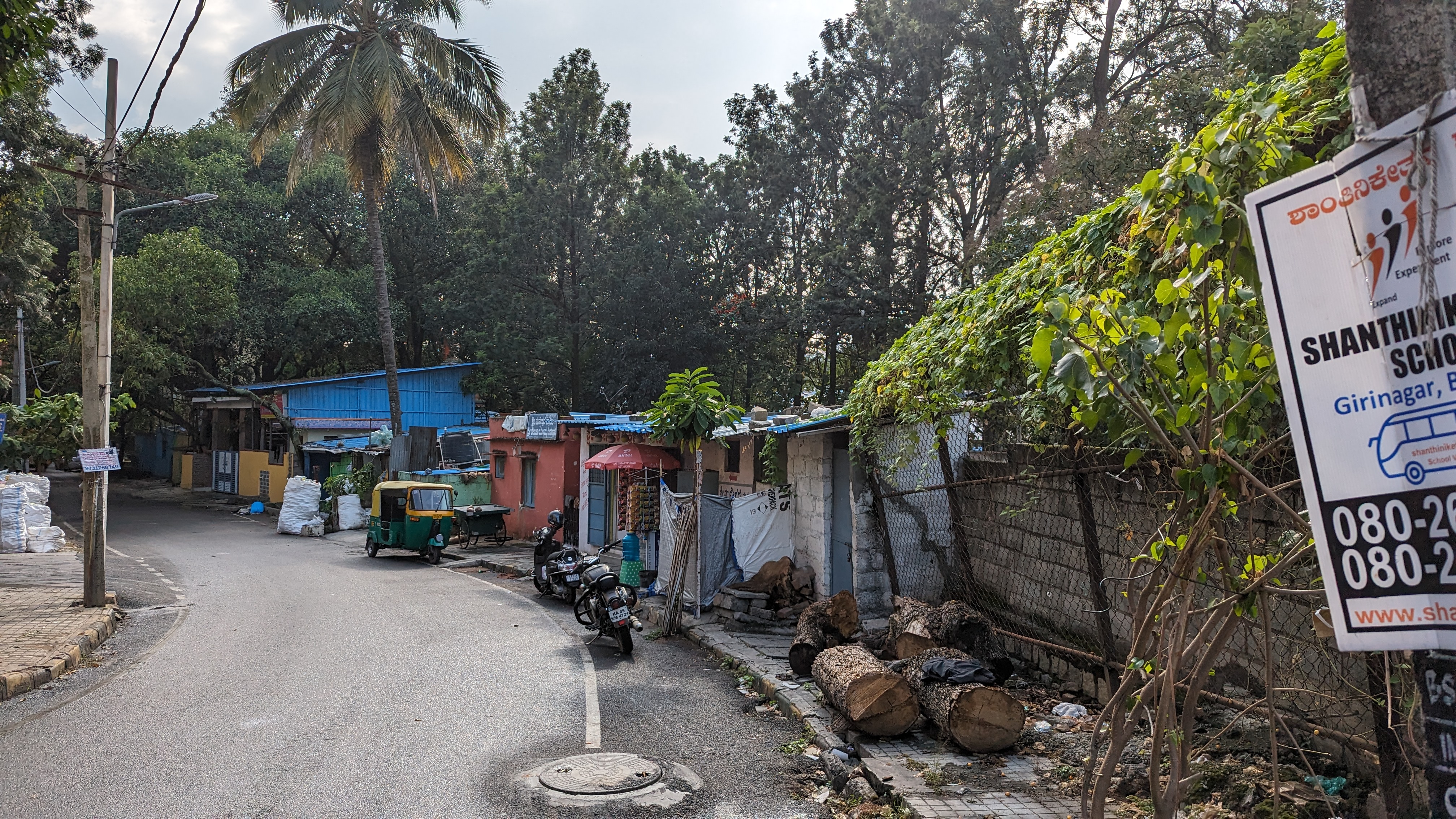
The kaluve is not a fully open drainage system. Most of the times, while travelling by roads it becomes hard to walk exactly alongside a kaluve. One stretch of the kaluve is the underground and has settlements on top and beside the drain. It was also observed that in such cases, often sewage from houses on top of the drain are often let into these kaluves.
The kaluve cuts through densely populated areas and by design forms a junction of roads. These roads tend to be narrow and cause traffic congestion. In more residential areas, the buildings are sometimes very close to the kaluves and do not seem to follow the mandatory 50m buffer zone as instructed by the BBMP.
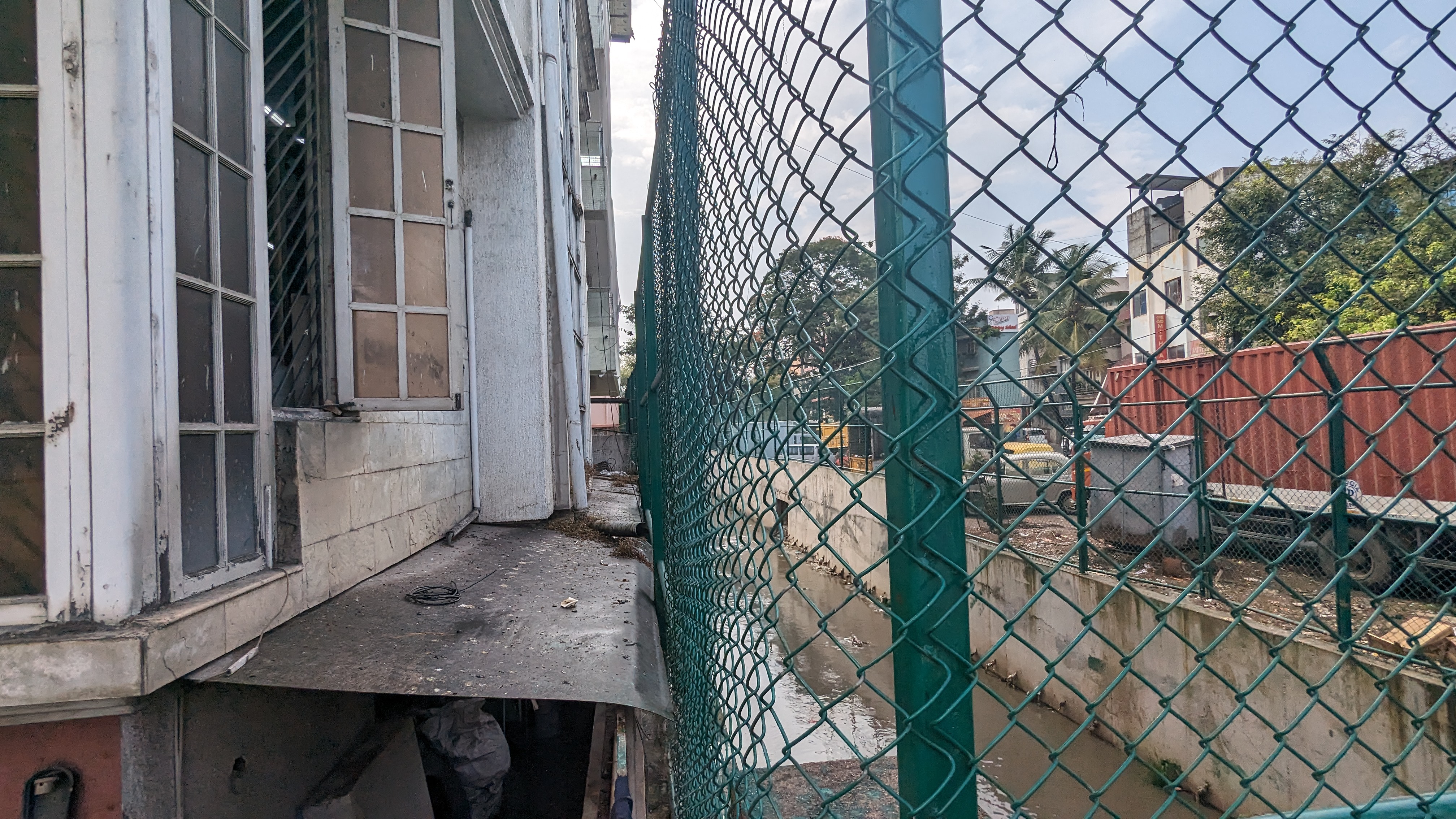 {width=“70%”}
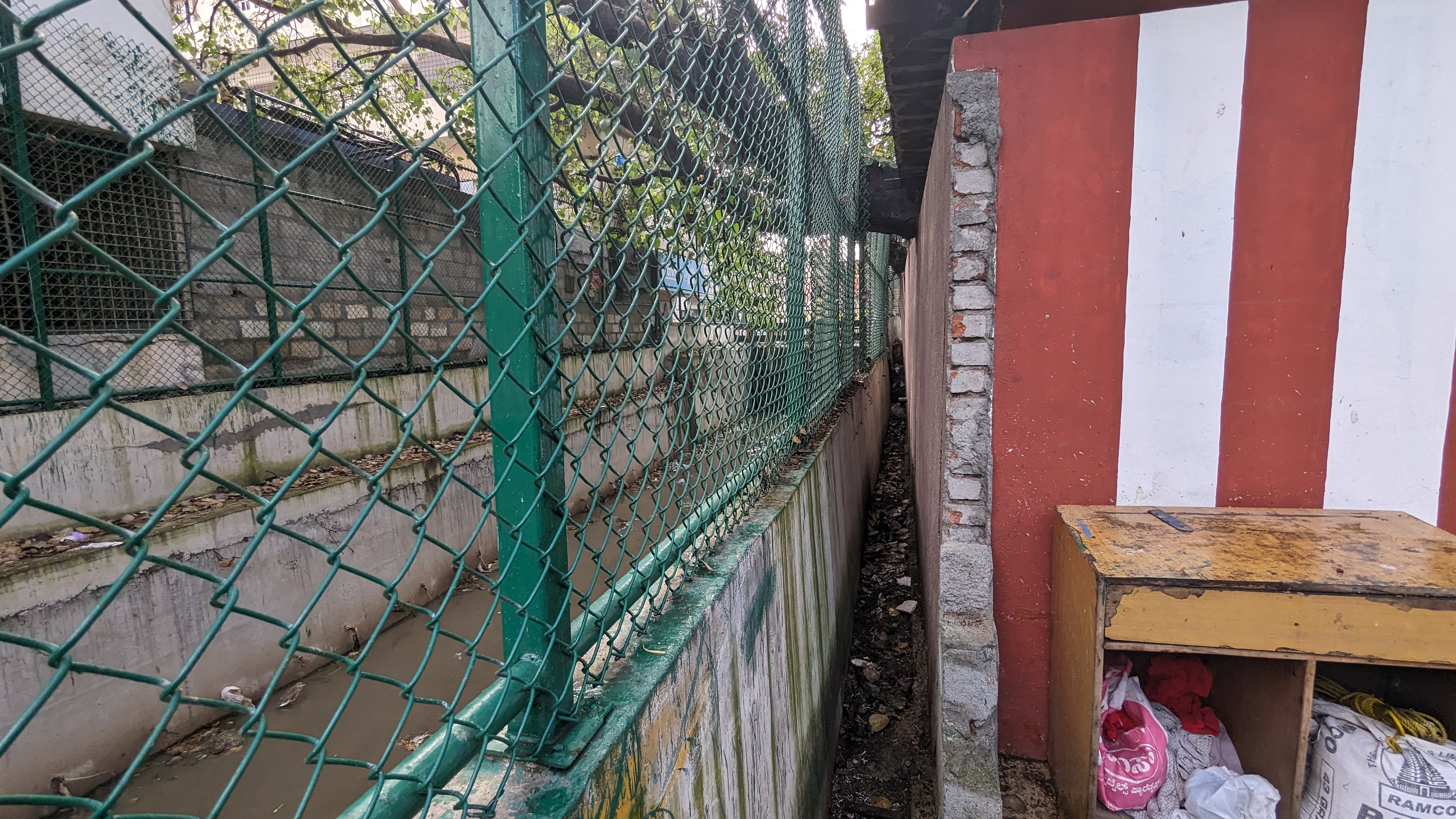 {width=“70%”}
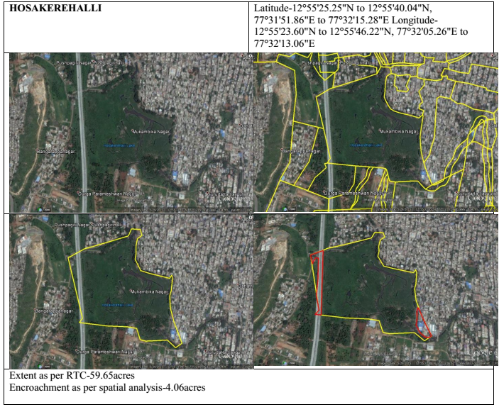
- The Hoskerehalli lake is the end point of the Kaluve. The lake was supposed be rejuvenated in January 2019 but the project was abandoned halfway (Niranjan Kaggere, “Shoddy BDA work to blame for hosakerehalli lake mess”, n.a.). The sewage from the nearby buildings and the water from the kaluve are being discharged into the lakes. There were supposed to be walking paths constructed around the lake, but the construction has stopped and the debris around the lake has encouraged more garbage dumping in the vicinity.
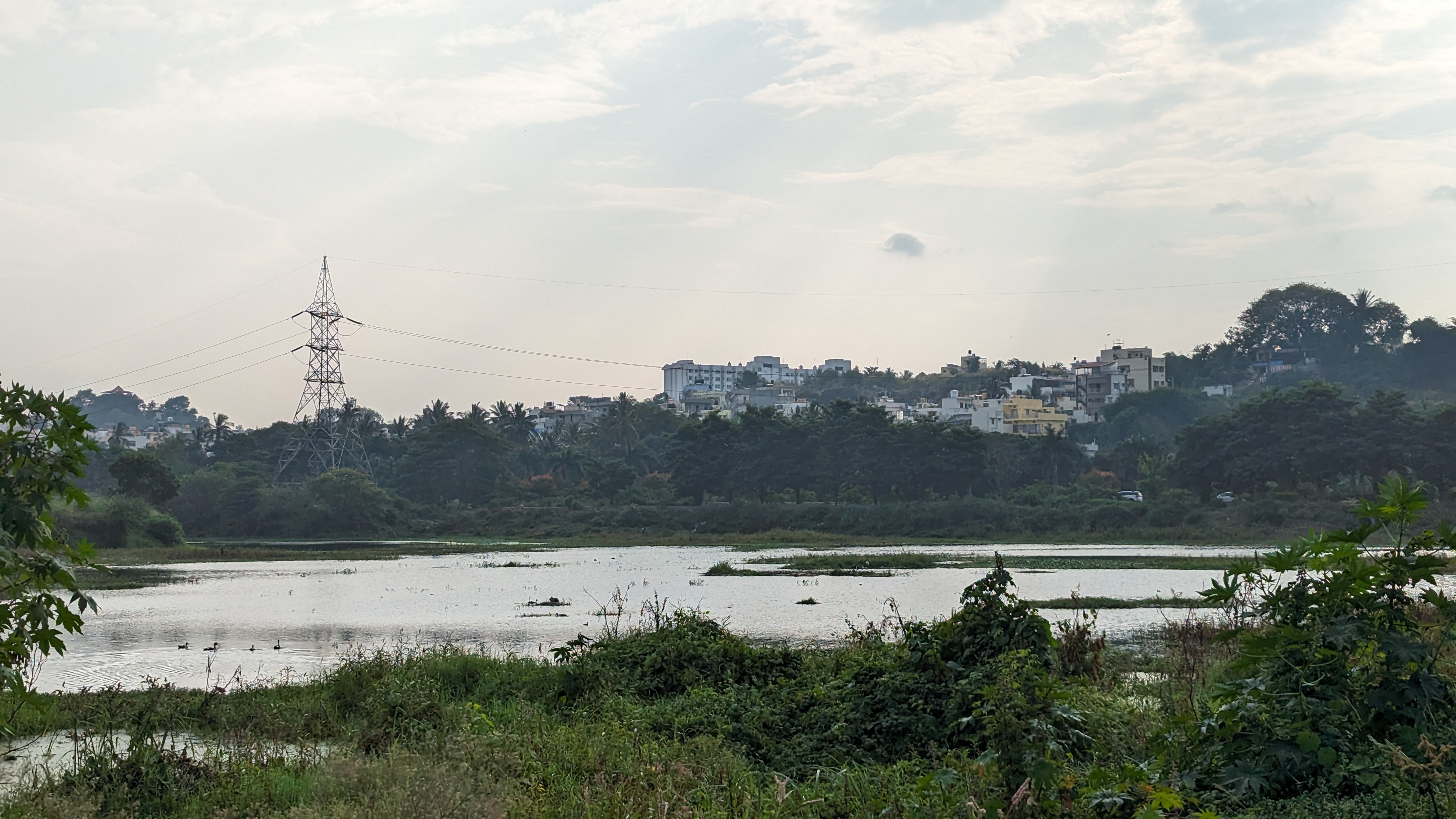 {width=“70%”}
 {width=“70%”}
A K100 like model for the Thyagaraja Nagara - Hoskerehalli kaluve
The basic idea or objective of the K100 is to re imagine Rajakaluves as a space for public engagement. This would involve mainly cleaning up the space in their present condition and building infrastructure around the drains to make it more pedestrian friendly. A model like that would prove to be effective in this context but would come with a set of challenges that may require planners to rethink the solution especially in terms of the infrastructure. The first part of cleaning up and de-silting will prove to be very effective because this kaluve has a lot of illegal sewage inlets, garbage dumping problems. The idea of introducing a sewage treatment plant at the upstream of the drain will be very helpful in ensuring clear water flows through the drains and clear water enters the lake. Infact it would also be useful to introduce an STP at the Hoskerehalli lake to ensure that the lake is not polluted. The challenge mainly occurs however in the way the K100 model looks at redesigning the public space around the kaluve. The kaluve passes through residential and commercial areas like which means that many buildings are in a very close vicinity of the drain.
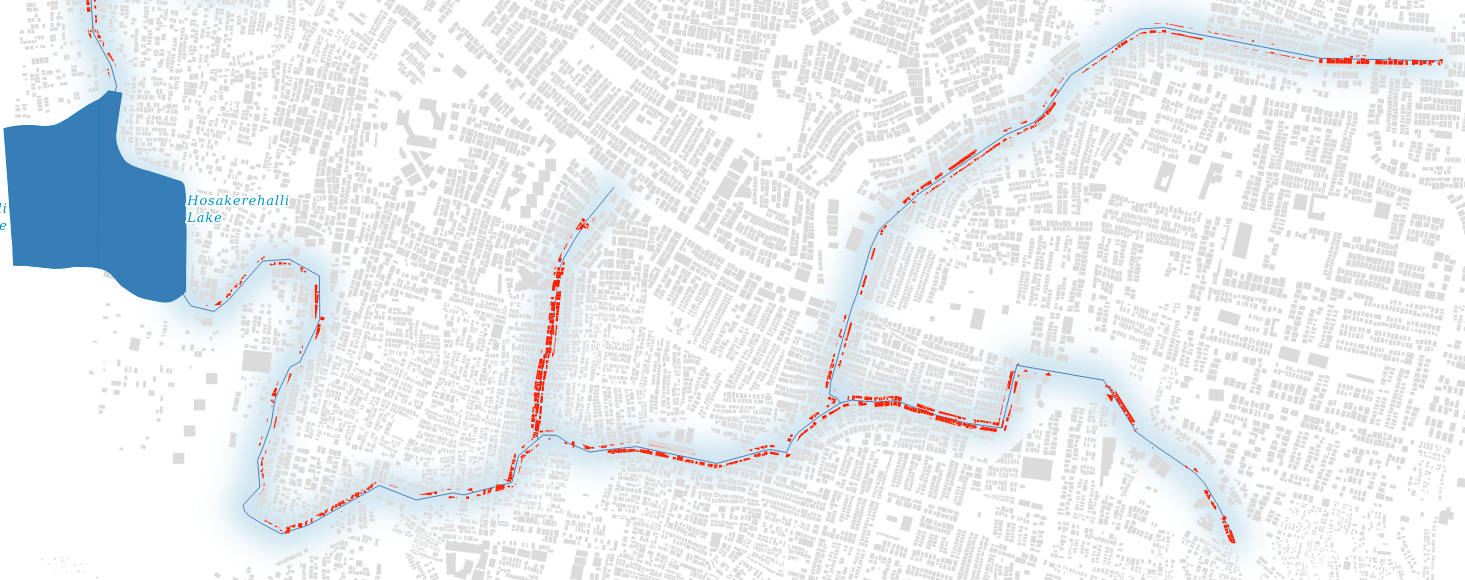
A GIS analysis was performed to understand the number of buildings around the Kaluve, the storm water drain system data was extracted from openstreetmaps and the buildings data was taken from Google’s open building footprint data. The analysis highlighted that around 970 buildings along the stretch of the kaluve that lie in a buffer zone of 50 metres from the drain and its tributaries. In the figure, the buildings in red are the buildings that fall in this zone. There have been cases in the past where BDA has called for mass demolition of houses that encroach a rajakaluve. A public infrastructure that enables end to end walking/cycling paths would call for these buildings to be demolished and space around the drain to be widened for public spaces. This could prove to be very difficult as there are a lot of buildings that are in the affected zone some major stretches of the drain lie underground, which means that there are roads and buildings build on top the drain system. The solutions to enable pedestrian commute seamlessly require more rigorous planning and thought in contexts like this.
Conclusion
The K100 project and the idea of a citizen waterway puts forth an idea of a Bengaluru that enable pedestrians to commute from one place to another along a perennial running stream of a kaluve. This is especially important in a city like Bengaluru because there is a lack of public spaces that are always open. The citizen waterway promises a public infrastructure that not only acts as a recreational space but also adds utilitarian value in choosing a scenic alternate to traveling on road. While the idea holds a lot of value and power, the execution comes with its own set of challenges as Bengaluru is very diverse in its settlements. This paper highlights one such kaluve and the challenges that could come up in re imagining it. This paper in its approach and methodology acts a starting point to imagine kaluve centered audits of spaces that study trends of urbanization, waste-disposal, sewage drainage systems, settlements, and public engagement. Audits like these need to be performed for all primary storm water drains in Bengaluru and then the secondary ones. This then enables planners, designers and architects in reimagining the conceptualizing and executing a project as visionary as the K100 citizen’s waterway project.
Bibliography
Azizi, Ali, B. Malakmohamadi and Hamid Reza Jafari. “Land use and land cover spatiotemporal dynamic pattern and predicting changes using integrated CA-Markov model.” Global Journal of Environmental Science and Management 2 (2016): 223-234.
Batty, Michael, and Stephen Marshall. “Centenary Paper: The Evolution of Cities: Geddes, Abercrombie and the New Physicalism.” Town Planning Review 80, no. 6 (November 2009): 551–74. https://doi.org/10.3828/tpr.2009.12.
Hebbar, R, V Poompavai, R Sudha, T R Nagashree, S Ramasubramoniam, K S Ramesh, K Ganesha Raj, et al. “Assessment of Long-Term Changes in Lakes and Natural Drainage Patterns of Bengaluru City Using Historical Satellite Images,” n.d.
Jain University, Meena Y.R, and Anil Kumar Gupta. “Evaluation of Stormwater BMPs Performances for Flood Volume Reduction in Bengaluru City, Karnataka, India.” International Journal of Civil Engineering 5, no. 7 (July 25, 2018): 5–10. https://doi.org/10.14445/23488352/IJCE-V5I7P102.
Lawrence, Denise L. “The Built Environment and Spatial Form,” n.d.
Mathanraj, S, N Rusli, and G H T Ling. “Applicability of the CA-Markov Model in Land-Use/Land Cover Change Prediction for Urban Sprawling in Batticaloa Municipal Council, Sri Lanka.” IOP Conference Series: Earth and Environmental Science 620 (January 9, 2021): 012015. https://doi.org/10.1088/1755-1315/620/1/012015.
Mundoli, Seema, B. Manjunath, and Harini Nagendra. “Effects of Urbanisation on the Use of Lakes as Commons in the Peri-Urban Interface of Bengaluru, India.” International Journal of Urban Sustainable Development 7, no. 1 (January 2, 2015): 89–108. https://doi.org/10.1080/19463138.2014.982124.
Niranjan Kaggere, D. (n.d.). Shoddy BDA work to blame for hosakerehalli lake mess. Retrieved from https://www.deccanherald.com/india/karnataka/bengaluru/shoddy-bda-work-to-blame-for-hosakerehalli-lake-mess-775176.html
Rajagopal, R. (2022). Retrieved from https://bengaluru.citizenmatters.in/all-about-k100-stormwater-drain-citizens-waterway-project-69378
(2023). Retrieved from https://www.youtube.com/watch?v=I0akctyI4Us&pp=ygUWazEwMCBjaXRpemVucyB3YXRlcndheQ%3D%3D
Ramachandra, T V, and Bharath H Aithal. “Decaying Lakes of Bengaluru and Today’s Irrational Decision Makers,” n.d.
Ramachandra, T V, Bharath H Aithal, S Vinay, and Aamir Amin Lone. “ENVIS Technical Report 55,” n.d.
Ramachandra, T V, and Sincy Varghese. “WATER SITUATION IN BENGALURU.” Technical Report, 2016.
Scott, James C. Seeing like a State: How Certain Schemes to Improve the Human Condition Have Failed. Yale Agrarian Studies. New Haven: Yale University Press, 1998.
Tuan, Yi-Fu. Space and Place: The Perspective of Experience. 7. print. Minneapolis, Minn.: Univ. of Minnesota Press, 2011.
Viswanathan, Radhika. “Bangalore and Its Lakes,” n.d.
“WETLANDS: TREASURE OF BANGALORE.”, IISc Accessed September 24, 2023. https://wgbis.ces.iisc.ac.in/energy/water/paper/ETR101/content.html.